

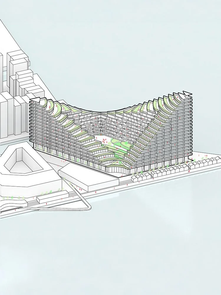
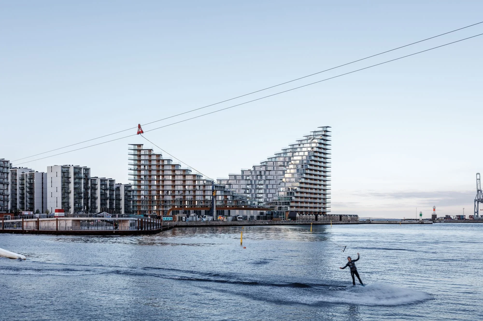
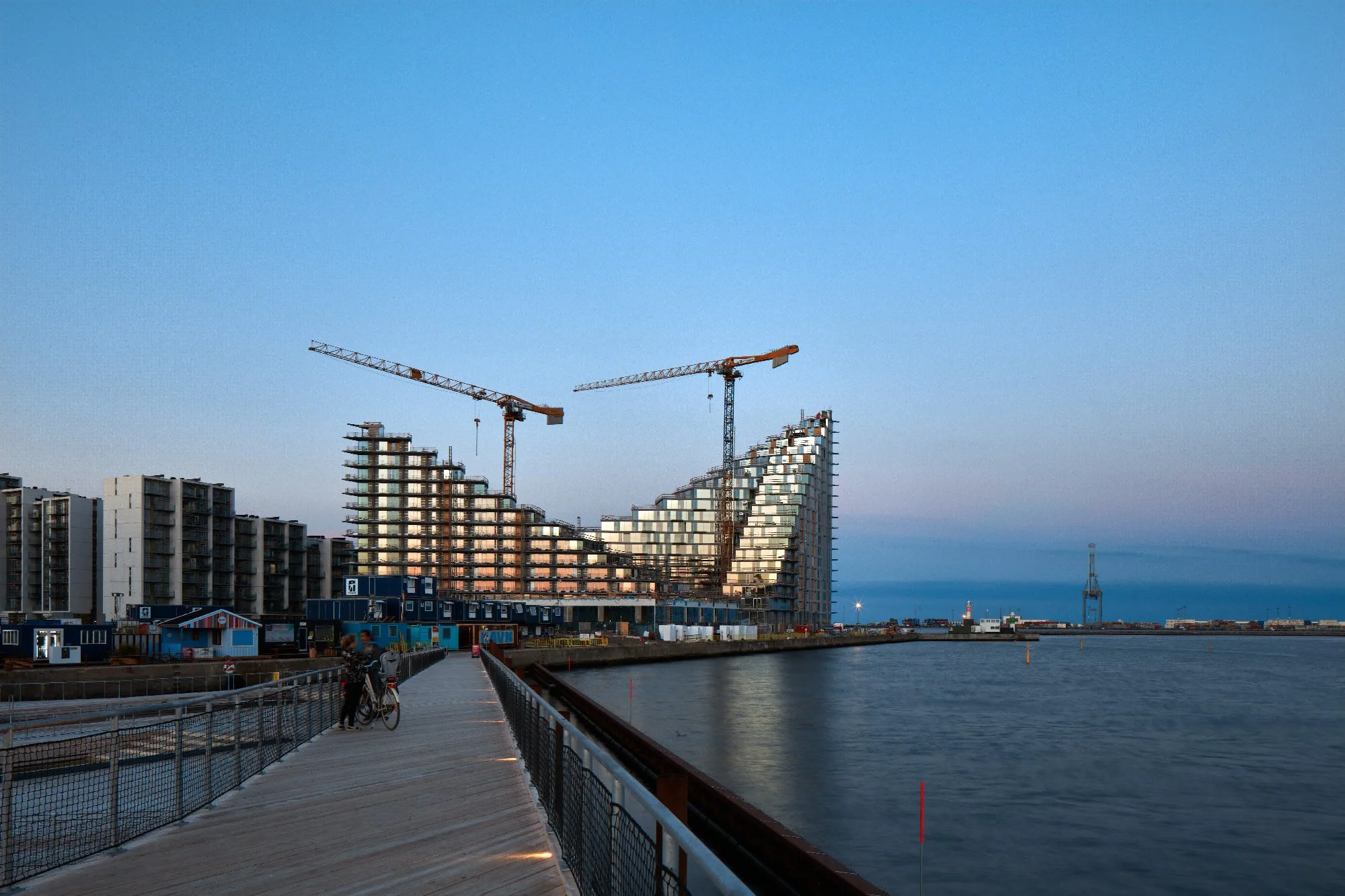
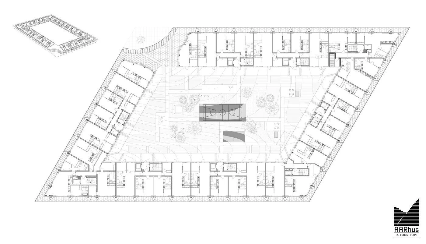
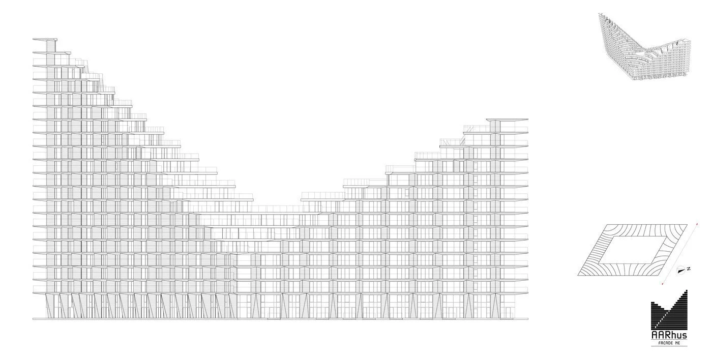
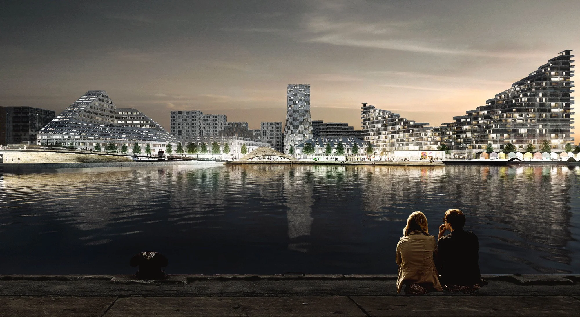
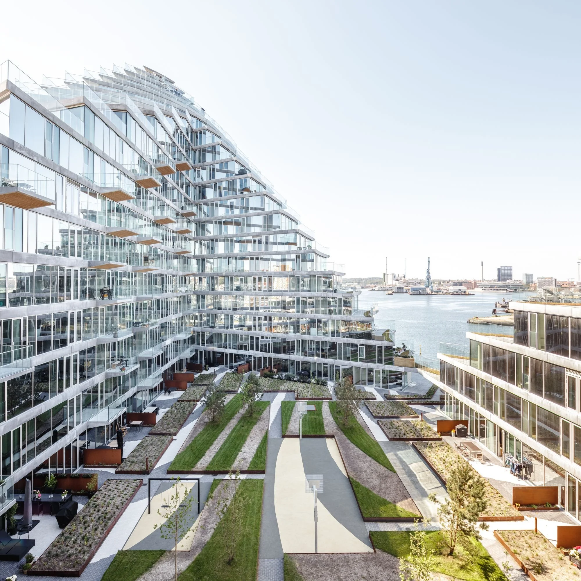
奥胡斯港口浴场

-
规划是设计公共空间的二维练习。它的词源源于平整飞机的概念。但城市本质上是三维的。 Nolli 地图是罗马的传奇描绘,它没有区分内部和外部,而是区分公共和私人。教堂大厅、市场大厅和市政厅被展示为公共场所,创造了一种公共领域在屋顶下和外墙后面延伸的意识。通过将 Nolli 地图扩展到三维,我们可以将思维从规划扩展到空间,将共享空间从底层运输到 Z 轴上下的目的地。
轴、对角线、视线、门户、门廊和通道的传统规划工具被扩展为包括坡道和屋顶、螺旋和弹簧、地形和平台、壁架和前景。通过加入第三维度,建筑不再是有限地块的零和游戏,而成为上层印刷地产的艺术。天空中的维尔京群岛。
Z 轴从地平线向两个方向延伸。想象一下,三所学校围绕着一块中央层叠的程式化法罗群岛坠落。一条巴黎地铁将天空带到隧道,向戴高乐传奇的 1 号航站楼的复古未来主义致敬。一所学校堆叠和扇形单层建筑,将教育扩展到各个层面的户外活动。一座将高线延伸到天际线的摩天大楼。一堆层叠的绿洲悬浮在塔和绳索之间的半空中。作为城市立面的终极例子,想象一个仓库附近,柱子森林承载着一系列建筑物,形成层层环绕的周边街区。在建筑物之间、下方和上方,一个三维公共领域穿插并相互连接,在 X、Y 和 Z 之间创造新的平等。通过提升我们的建筑物和景观、私人和公共空间、街道和广场,我们正在挤压 Nolli 地图以成为 Nolli 模型,以期我们将在所有三个维度上毫不费力地移动的未来。Planning is a two-dimensional exercise for designing public space. Its etymological roots come from the notion of leveling a plane. But the city is inherently three-dimensional. The Nolli Map is a legendary depiction of Rome that didn't make the traditional distinction between inside and outside, but rather between public and private. Church halls, market halls, and city halls were shown as public, creating an awareness that the public realm extended under roofs and behind façades. By extending the Nolli Map into the third dimension, we can expand our thinking from planning to spacing, transporting shared spaces from the ground floor to destinations up and down the Z-axis.
The traditional planning tools of axis, diagonals, sight lines, portals, porticos, and passages are extended to include ramps and rooftops, spirals and springs, topographies and platforms, ledges and outlooks. By adding the third dimension, architecture ceases to be a zero-sum game of limited ground, and becomes the art of printing real estate in the upper strata. Virgin islands in the sky.
The Z-axis extends in both directions from the horizon. Imagine three schools wrapped around a central cascading piece of stylized Faroese fell. A Parisian Metro bringing the sky to the tunnel in an homage to the retrofuturism of Charles De Gaulle's legendary Terminal 1. A school stacking and fanning single-story buildings to expand education to the outdoors on all levels. A skyscraper that continues the High Line into the skyline. A stack of cascading oases suspended midair between tower and guy ropes. As the ultimate example of urban elevation, imagine a neighborhood of warehouses, where a forest of columns carries a series of buildings, forming layers of perimeter blocks hovering above. In between, under, and above the buildings, a three-dimensional public realm is interspersed and interconnected, creating a new equality between X, Y, and Z. By lifting our buildings and landscapes, private and public spaces, streets and squares, we are extruding the Nolli Map to become a Nolli Model, in anticipation of a future when we will move effortlesslv in all three dimensions.

